MountainBikeTx.com
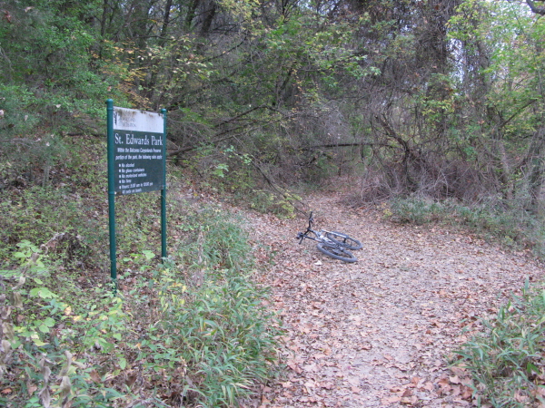
St. Edward's Park
Austin, TX
Click here for help on how to read this trail guide
Directions:
Length:
Technical Level:
Trail Type:
Configuration:
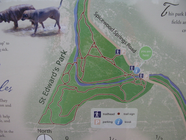
Trail Map(s):
Fee:
Trails:
Amenities:
Links:
Contact:
Comments:
Photos:
Video:
Trail Review:
5 miles
2-4
singletrack; wide path
network
none
n/a
none
(512) 974-6700
Click here to send an email
• Also check out Bull Creek Greenbelt


unavailable
Once upon a time, St.
Edward’s Park was connected to other nearby parks, making a nice network
of trails. Unfortunately, however, the area that allowed it to be connected,
Forest Ridge, is no longer a legal place to ride for mountain bikers.
Nevertheless, St. Ed’s is functional as a standalone park.
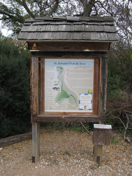
Perhaps the most difficult aspect of St. Edward’s Park is that the park map
located at the trailhead fails to reflect all of the trails one will
come across. Granted, some may be rogue trails, but many that don’t
seem to be found on the map do seem to be legitimate trails. Although
that may make for a bit of frustration, it doesn’t deter from the fact
that St. Edward’s has some decent trails.
Considered more of a network of trails than anything else, St. Edward’s can
be broken down into an out and back or two and multiple loops.
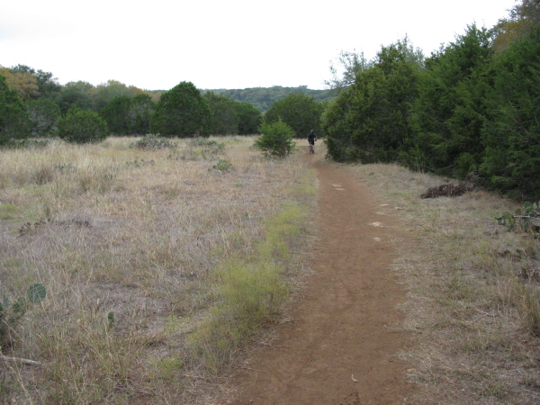
The out and back trails are suitable for pretty much any rider out there,
no matter how new they may be to mountain biking. As a matter-of-fact,
if you stay on the east side of Bull Creek the trails seem to generally
stick around a 2 as far as technical level is concerned. Once you cross
the creek, however, tech level 4 conditions are quite possible. The
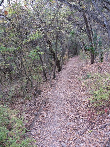
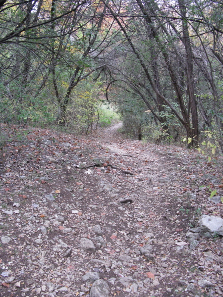
out and back sections along the east side of Bull Creek are generally
smooth singletrack, with the occasional wide path section. Suitable
for any rider, the out and back heading north is a sweet 1/2 mile of
singletrack (one way). With only one spot I can recall that would be
considered a bit difficult, this trail is definitely a pleasant one.
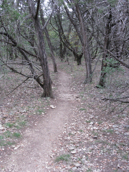
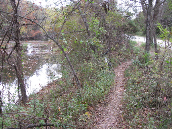
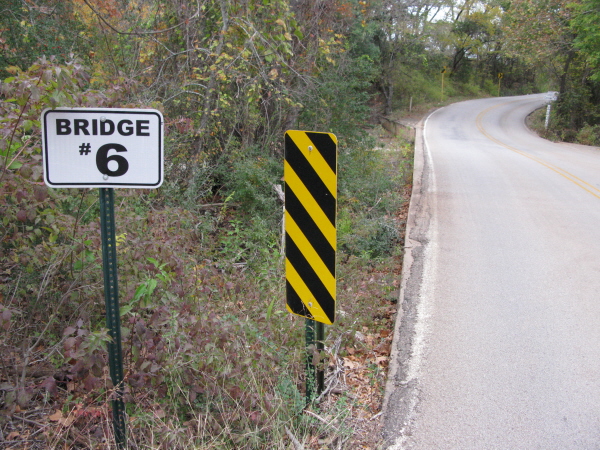
At one point the trail is intersected by a road, but it isn’t until
you reach the Bridge #6 side that you know it’s time to turn around.
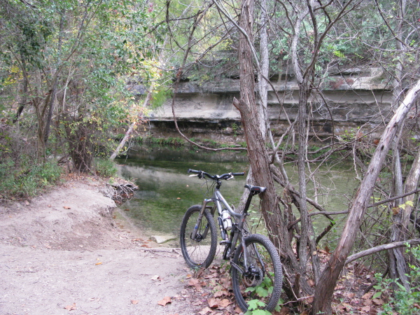
On the return trip you may find yourself alongside the creek itself.
Although the trail is a little more challenging in places, it isn’t
too difficult even for the new rider.
On the opposite, out and back (south side of the park), however, the trail
seems to vanish alongside the road. If you passed an opening in the
fence take it and turn right where the trail splits. Welcome to the
west side! The west side of St. Edward’s Park couldn’t be further from
beginner friendly. You have a couple choices here:
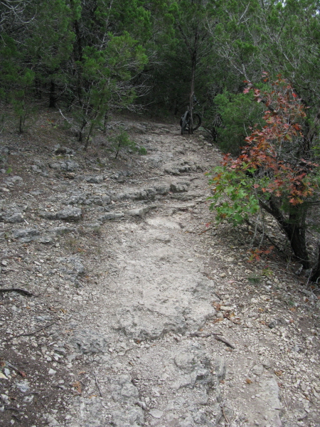
1) Follow the rocky wide path up the hill and then bomb back down. Keep
in mind that you are looking at close to a mile climb (but that’s close
to a mile descent!),
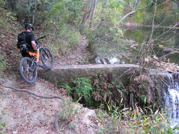
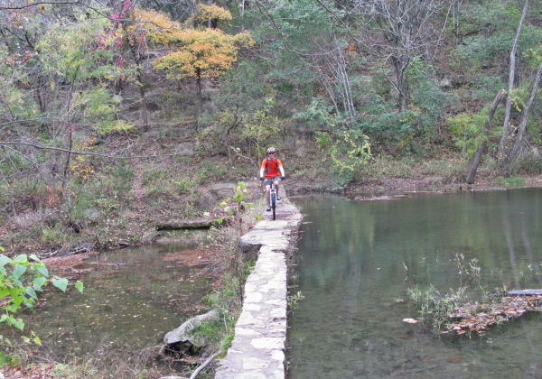
2) Start up the rocky path, turn right at the split, then go straight
at the next split (going right at the this split will send you down
a short hill back to the creek, which will lead you to the concrete
dam/break). After traveling along some rocky sections you will come
to somewhat of a rocky opening. Going left here will take you back to
the rocky path, but taking a right will send you somewhere else altogether.
If you decided to go right make sure you have a good sense of balance and
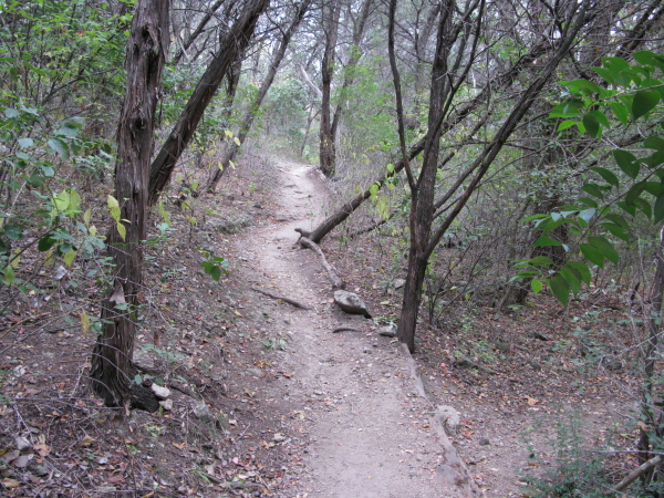
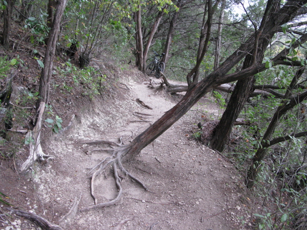
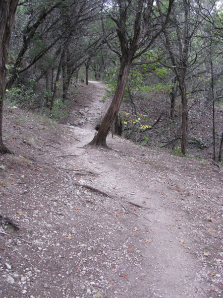
lack the tendency to look where you don’t want to go. As you work your
way up the trail, you’ll find yourself navigating over roots and around
trees, but soon enough you will see that the trail runs directly along
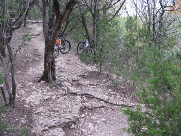
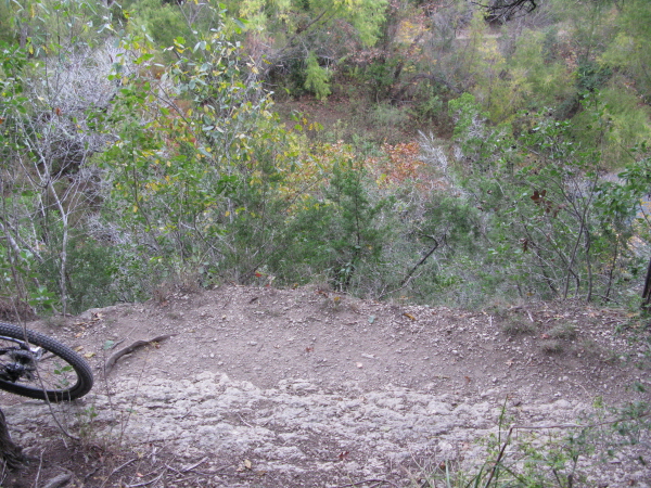
the ledge overlooking the creek. Don’t look down or else you may find
your bike heading towards a 100 foot descent [see photo]. Eventually
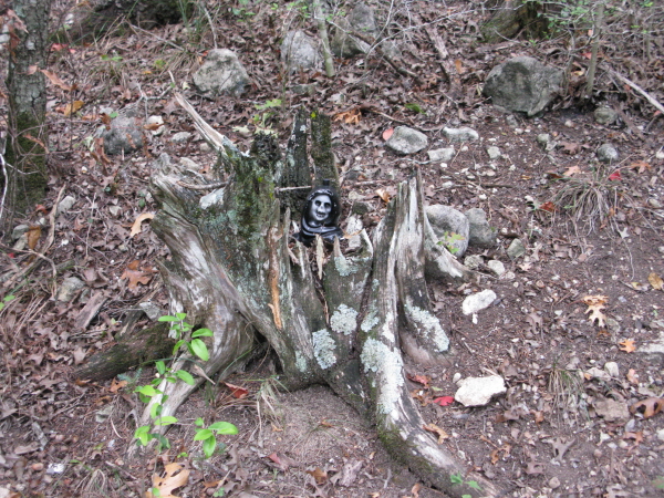
you will come to yet another split in the trail (you’ll know you’re
there by the little guy in the tree stump [see photo]. One direction
takes you into a deep ravine and back out (not all too rideable, though),
while the other takes you up a long, loose climb featuring off-camber
sections. I can’t say whether the climb is worth it in the end since
my bike decided it would put a stop to the climbing by suffering a technical.
If you have made it all the way up this climb, let us know how it went
so we can complete this review.
~ MountainBikeTx.com