MountainBikeTx.com
Reveille Peak Ranch
Burnet, TX
Click here for help on how to read this trail guide
Directions:
Length:
Technical Level:
Trail Type:
Configuration:
Trail Map(s):
Fee:
Trails:
Amenities:
Links:
Contact:
Comments:
Photos:
Video:
Trail Review:
62 miles
2-5
singletrack; doubletrack; ranch road
loops
$10/person
Upper Loop/Trail | Lower Loop/Trail
ŌĆó Restrooms
ŌĆó On-site bike repair shop
ŌĆó Super D course (1.5 miles)
ŌĆó Downhill course and skills park (.6 miles)
ŌĆó Flow Track (1+ miles)
ŌĆó Pump Track
Reveille Peak Ranch website | Trail Details
(512) 755-1177 or (512) 914-8479
Click here to send an email
ŌĆó Hours: Wed-Sun from 8 a.m.-5 p.m. (calling ahead is highly recommended)
unavailable
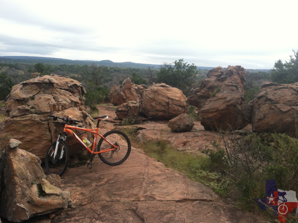
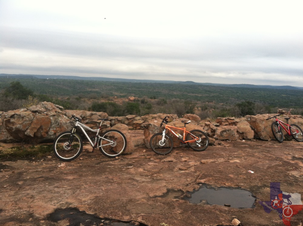
Reveille Peak Ranch has some of the best
XC/Trail Mountain biking terrain in all of central Texas. With 50+ miles
of single track and jeep trails its a wonderful mountain bikers paradise.
It has flowing, high-speed cross country tracks (e.g., High Fence Line
Trail and Race Loop) to downhill tracks (e.g.,the Super D) to freestyle/pumptracks
(i.e., Flow Track).
Most of the trail system is either packed soil, crushed granite or exposed
granite shelving, which are all great. Soil is nice and tacky and granite
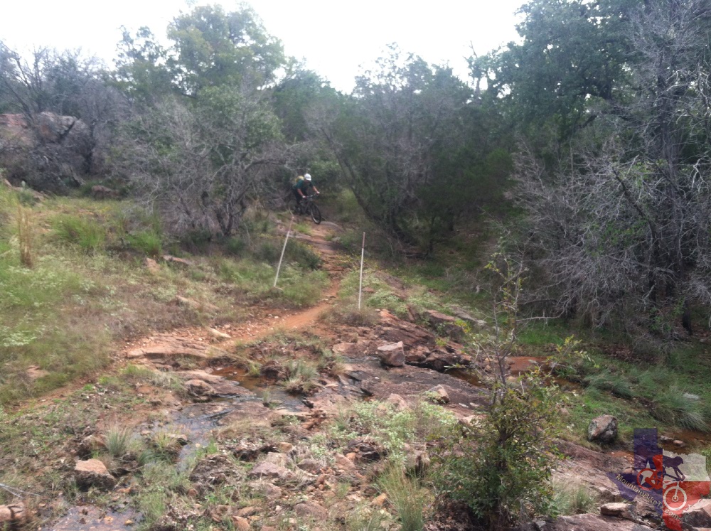
has amazing grip. Flow Track is a one-way downhill flow track to practice
your jumps, speed and in general, your flow and control on your bike.
You can access the top again via the South Pole Jeep Trail so you can
do it all over again. The Race Loop and High Fence Line Trail are both
easy to find with similar difficulties, with the exception that the
Race Loop has a few more obstacles. Trail system is excellently marked
making it practically impossible to get on the wrong trail.
Definitely worth the drive for the amazing trails.
~ Sean Kupec (March 2014)
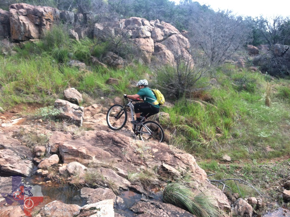
The trail system is comparable to
Flat Rock [Ranch] in terms of technical challenge.
The 9 mile lower loop is mostly intermediate, with some beginner sections.
The upper loop is intermediate/advanced, mostly rock and more demanding
both in technical level and in elevation change.
The Super D should be scouted before bombing down it. It's all fun. The granite
outcroppings are remiscent of Moab Slickrock and the views are outstanding.
Ride it all. You'll get better and better every time.
~ Cynthia Weisinger (February 2011)
The start [of the 8-mile race loop] is a jeep
road that meanders up in to the some low hills for about the first mile;
good climbing, not hard, but a good warmup for what lies ahead. [Eventually
you hit some] smooth flowing singletrack for about 100 or more yards.
You go up and over some small rock formations around some trees and
another easy left back on to a jeep road.
As you drop back into the trail it starts off with some short, easy climbs
over mostly dirt with some rocks mixed in. The more you progress into
the trail the tougher it gets. Some of the climbs out here are really
technical. The trail designer didn't always take the easy way around
and really used a lot of the natural rock formations to their advantage.
You will be cranking up some steeper sections, glance about 50 yards
ahead and see some very narrow passes through wedge like rock formations
that I personally could not get through without hitting my cranks on
the rock. I would say there are at least three or four really tough
climbs. I was asking myself a time or two what was i doing out here,
but as I crested the hill and saw the downhill laid out in front of
me, I realized that all the oxygen I spent getting up was well worth
the trip down. [ed.]
There are bright orange hash marks to designate which way the trail should
go and some man-made rock towers about 3-ft tall that you can aim for
like pole gates on a slalom course. There are two creek crossings: one
was completely dry and the other had a small trickle to it. There are
a couple of sections where they actually used rocks from the surrounding
terrain and built up the ground so you can go around a tree or hang
on to the edge of rock ledge.
The last mile of the course was a real treat. You're pedaling up a jeep road
and you come to a tall fence; go through and drop in to the singletrack
again. Every foot [of trail] in is another tic on the speedo. You roll
through a few trees and then out in to a grassy section, [featuring]
nice an easy left and rights so you donŌĆÖt have to scrub off any speed.
You climb up a small hill and back out on to the original jeep road.
As you accelerate down the road, you see the earthen dam you'll have
to go over, then return to the parking lot and pavilion. [ed.]
The Super D course starts at the top of Reveille Peak and drops over 400
ft, from what I am told. Within the first couple hundred feet there
is a small 2-ft hill with an 8-ft, 45 degree incline that you have to
go down. After you go across a short slick rock section it opens a little
and then there is about a 3-ft drop. It continues down through some
rock garden type sections another 3-ft drop. They put in a nice smooth
ramp about halfway down the Super D course and a lot of guys were catching
some nice air on it. After the gap you drop into part of the normal
singletrack loop and continue down through the trees over some more
slickrock up and around more rock gardens and through the trees to the
finish line for the Super D.
~ Wes Comeaux (February 2011)